
16 Top Things to Do in Kings Canyon National Park
You’re probably planning a trip through California’s Sierra Nevada and already know you want to visit Yosemite and Sequoia National Parks. But Kings Canyon is harder to figure out.
It’s awkwardly shaped. It can just seem like Sequoia 2.0. And some of its best scenery seems weirdly difficult to reach.
After three day-hiking trips and at least five wilderness backpacking trips in Kings Canyon, I can confidently say it deserves a place on your itinerary. The park offers quieter trails, enormous sequoias, and the most dramatic canyon drive in California.
I’ll show you what to see in Grant Grove and Cedar Grove, explain what is actually inside the national park, and help you choose the best stops and hikes that are worth your limited time.

Backcountry Emily contains affiliate links and I may receive compensation - at no extra cost to you! As an Amazon Associate I earn from qualifying purchases. See my Privacy Policy for more information.
Map of the Best Things To Do in Kings Canyon
The sights in this guide are ordered roughly the way you’ll encounter them while traveling through Kings Canyon. You’ll begin around Grant Grove, continue down the Kings Canyon Scenic Byway toward Cedar Grove and Road’s End, and finish with a few worthwhile stops in the surrounding Sequoia National Forest if you have time.
If you’re still figuring out the layout of the park, read my complete Kings Canyon planning guide first.

See the General Grant Tree
The General Grant Tree is kind of tied for the second largest tree in the world by volume! I’ll let you read about the intricacies in what to include in measuring tree volume from the NPS. No matter what, it’s a BIG tree and it has also been designated the Nation’s Christmas Tree.
I love walking the easy 0.4 mile paved path to see the General Grant in Grant Grove, along with a few other sights like the Fallen Monarch, Gamblin Cabin, and Centennial Stump.
Unlike the General Sherman in Sequoia, the Grant Tree is a little bit more hidden in the grove and I feel like there’s slightly less fan fare. But, the way the light seems to always stream in and douse the Grant in a golden glow is pretty magical. So it’s worth a stop even after seeing Sherman!

Sunset at Panoramic Point
Panoramic Point shouldn’t be missed on your visit to Kings Canyon. It’s a short uphill walk (0.5 miles round trip) to the viewpoint where you’ll see Hume Lake below you, surrounded by the Sierra mountains.
I’ve been here for sunset twice, and it’s an incredible experience: especially with how intense the sun glows as it sets behind the trees to the west. I’d love to visit for sunrise to watch the sun break over the mountains.
A couple things to keep in mind:
- Air pollution is a problem in California’s Central Valley and you may experience this here. Both the nights I visited it was pretty hazy from air quality and probably fire smoke, so the mountains weren’t as sharp to the eye as I was hoping. It’s still beautiful.
- The road is very narrow and windy in parts. Longer vehicles like RVs won’t be able to make this drive, but a 22 ft campervan should be fine.

Hike to Park Ridge Lookout
From Panoramic Point you can continue hiking the ridge to a volunteer-manned fire lookout: Park Ridge.
I decided to hike it during golden hour and sunset near the summer solstice, starting around 6:45 pm, and got back to Panoramic Point around 9:10 pm. I wasn’t able to go inside the lookout at this time – the visiting hours are 10:30 am – 5:00 pm.
The sunset views were even more incredible along the ridge than Panoramic Point, and you can get some better mountain views just past Panoramic Point and then again closer to the lookout. The wildflowers were also so beautiful in mid-June.
I’d say this hike isn’t a must-do if you’re short on time, but I also had to share the summit area with a PG&E worker in his idling truck making a phone call (there is a maintenance forest road to the top as well), which kind of ruined the peace.
It’s a great hike though for getting off the beaten path in Kings Canyon and you’ll probably appreciate it if you get to go inside the fire lookout for even better, above-the-ground views!
Hike Stats
- Distance: 5.3 miles
- Elevation Gain/ Loss: 1,050 feet
- Trail Type: Out-and-back
- Difficulty: Moderate
- Trailhead: Panoramic Point Parking Lot
- Check current conditions and download on AllTrails
Hike Big Stump Loop
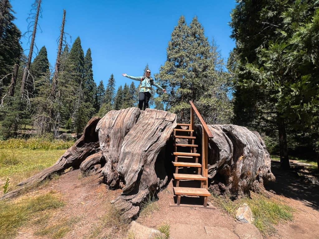
The Big Stump Loop is one of the most powerful reminders of human greed. This short hike takes you past hundreds of sequoia stumps in just a small area, with the largest being the Mark Twain Stump: the tree felled to bring to the World’s Fair as proof of these giant trees (and the east coasters laughed and called it a hoax).
While a trail of stumps might not seem fun, I think it’s an important stop and a great reminder of the importance of protecting the natural wonders of our world before humans wreck havoc.
Hike Stats
- Distance: 1.4 miles
- Elevation Gain/ Loss: 210 feet
- Trail Type: Lollipop Loop
- Difficulty: Easy
- Trailhead: Big Stump Picnic Area
- Check current conditions and download on AllTrails

Hike Buena Vista Peak
Buena Vista Peak is a short hike with some great views of the Sierra range, the Redwood Mountain Grove (which sadly burned), and the Central Valley.
I hiked this trail mid-day, but I’d probably recommend it as a sunrise or sunset hike for the best views, light, and cooler temperatures.
I haven’t yet hiked up Big Baldy, but they are on the same side of the highway, and I’m going to guess have relatively similar views. Big Baldy is about 400 feet taller than Buena Vista Peak but also twice as long of a hike. So depending on what kind of hike you’re looking for, I’d probably choose one or the other to hike.
I’d also say Buena Vista Peak has better views for less effort than the Park Ridge Lookout hike if you’re trying to decide between these and have limited time.
Hike Stats
- Distance: 2.1 miles
- Elevation Gain/ Loss: 400 feet
- Trail Type: Out-and-back
- Difficulty: Easy
- Trailhead: Buena Vista Peak Trailhead
- Check current conditions and download on AllTrails

Drive the Kings Canyon Scenic Byway
This is the road you’ll drive in between the Grant Grove and Cedar Grove areas of the park. And once you pass the Hume Lake area on the road, you’ll be greeted with some outstanding views.
Kings Canyon is argued to be the deepest canyon in the United States – at 8,200 feet deep between Spanish Mountain and the confluence of the Middle and South Forks of the Kings River. Which you can see on this drive at Yucca Point – a hairpin turn in the road. You can even hike the Yucca Point trail down to the confluence, though it’s steep and hot.
If you’re like me, you’ll just enjoy the views from the car, pulling over in the many turn-outs to take in the views. I personally love driving back up the byway during golden hour before sunset: the glow on these mountains is incredible, and the best pullouts are on the river side of the highway anyway, making it easier to pull over when you’re driving uphill.
Junction View is one the the best and largest pullouts on the highway, but make sure you also stop at 36.81730° N, 118.83970° W near Convict Flat Campground. It’s one of my favorite canyon views.
There is a private campground a little after Junction View called Kings Canyon Campground. You can make reservations on Hipcamp. I stayed here one time before a backpacking trip, and it’s fine, just hot.
They have gas and ice cream when the main part is open, but those hours seem to fluctuate and shouldn’t be relied upon. But if they’re open… ice cream is always a fun road trip treat when it’s 90°F outside!

Hike Mist Falls
Mist Falls is by far my favorite hike in Kings Canyon National Park – and I think it is the best day hike in the park.
It might seem long and formidable at 8 miles round trip, but if you’re a regular hiker, you’ll probably think those 8 miles breeze by since the trail is pretty mild with very gradual uphill that gets a bit steeper as you approach Mist Falls.
The trailhead is located at Road’s End, right next to the wilderness office. There are pit toilets and a water fill station nearby. It’s a great opportunity to ask any ranger questions you might have too!
You can hike it fairly quickly, or take time to pull over and post up at some of the easy river access points along the way for a nice break, but make sure you hike all the way to Mist Falls, and take the time to enjoy the view of the Sphinx mountain behind you as you approach Mist Falls.
A quick note of caution on this trail: black bears are a common sight, as are rattlesnakes. So be aware of your surroundings and don’t approach wildlife. In both of these cases it’s best to back away and let them pass before continuing.
For rattlesnakes I will sometimes throw small rocks in the vicinity of the snake (don’t hit the snake) to encourage it to move along. Remember: a coiled snake is in striking position, a long snake is less of a danger.
Hike Stats
- Distance: 8 miles
- Elevation Gain/ Loss: 1,000 feet
- Trail Type: Out-and-back
- Difficulty: Moderate
- Trailhead: Road’s End / Bubbs Creek Trailhead
- Check current conditions and download on AllTrails
Swim at Muir Rock
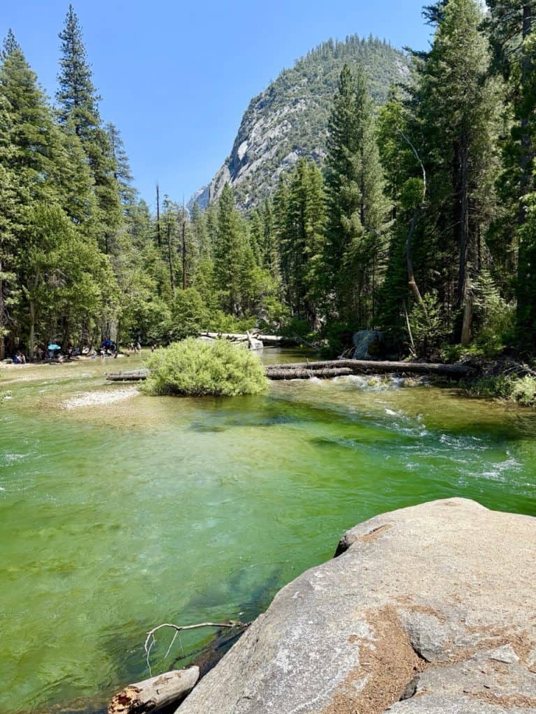
Muir Rock is a big rock right next to the South Fork of the Kings River at Road’s End. You access it via a very short trail from the main parking lot at Road’s End (it’s usually signed).
I spent about 3 hours here one afternoon just hanging out on the rock and jumping in the river from the top of the rock. It was a lot of fun, and there were many families partaking as well.
I highly recommend bringing a picnic and some folding chairs and setting up by the river’s edge. It’s beautiful, relaxing, and the river is the most gorgeous clear-blue-green color.
A word of caution: It’s definitely fun to jump in and swim in the river, but the river current is very strong here, and you should not swim across the river, especially in early summer. I watched 2 young girls almost get swept downriver and watched their father struggle to catch them and stay afloat himself. It had a happy ending but all of us watching had our hearts collectively stop and no one was breathing for those few seconds.
Just be smart around the river. If you jump in from Muir Rock, stay close to the rock and exit as soon as the small beach behind the rock comes into view.

Stroll Through Zumwalt Meadow
Zumwalt Meadow is such a fun short walk in Cedar Grove. The mountain and meadow views are incredible, and you can hike up the trail to the rocks on the southern side, where you’ll get more of a birds-eye view!
Sadly the meadow trail was damaged and is closed so you can’t walk in the meadow right now, but I still think walking over the bridge on the river is fun and walking up to the trail closure sign still gives you wild views of North Dome peak.

See Roaring River Falls
This is a road-side stop in Cedar Grove with a 0.25 mile short, paved walk to the falls. It’s such a quick stop that it’s definitely worth it. While the falls aren’t very tall, they’re packed with power as the water comes shooting out of a small corner in the canyon wall.
I loved being here at the beginning of golden hour looking back at the canyon: the walls were starting to glow and I hadn’t seen views like that in Kings Canyon yet.

Hike Kearsarge Pass
Kearsarge Pass is not on the western side of the park. The trailhead is on the eastern side, off of Highway 395, but I wanted to mention it because it’s the shortest trail to access Kings Canyon from the eastern Sierra slope, and it’s also absolutely stunning.
The top of the pass is the border between Inyo National Forest and Kings Canyon. So this is one of the very few trails you can hike with your dog to the top of the pass: you just can’t hike down into the park with your pet.
If you’re petless though and want a slightly longer hike, continue down to Kearsarge Lakes or Bullfrog Lake to enjoy the views and swim in the lakes.
This is a super popular hike. You’ll see many backpackers and day hikers. I used it as a resupply trail when I was thru-hiking the PCT and the top of the pass is one of my all-time favorite views in the Sierra.
Hike Stats
- Distance: 12.6 miles
- Elevation Gain/ Loss: 3,490 feet
- Trail Type: Out-and-back
- Difficulty: Hard
- Trailhead: Onion Valley Trailhead
- Check current conditions and download on AllTrails
Go Backpacking
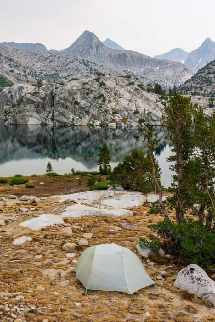
Getting further away from the main roads is one of the best parts of Kings Canyon, as the park is mainly designated wilderness.
One of the most popular multi-night treks is the Rae Lakes Loop, which you can access from Road’s End or Kearsarge Pass. I’ve done this full loop once and also hiked Rae Lakes and Glen Pass during my thru-hikes of the JMT and PCT and it is truly an incredible area and well worth the trek.
Some other popular backpacking trips include the Big SEKI Loop (or split it into the northern and southern loops) and Evolution Basin. Once you look at a map, you’ll realize that there’s lots of opportunity to get into the Kings Canyon wilderness from nearby forest trailheads near Courtright Reservoir, Florence Lake, South Lake, and Lake Sabrina.
You do need a wilderness permit to go backpacking in Kings Canyon, and you’ll reserve one through Sequoia-Kings Canyon, Inyo National Forest, or Sierra National Forest depending on your trailhead access point. Snow-free backpacking is generally available from July – September, but it really depends on the prior winter.
Sequoia National Forest Activities
Because Kings Canyon is surrounded by the Sequoia National Forest and you will drive through it when visiting the National Park, I wanted to make sure you knew about these other cool spots to visit on your trip!
These aren’t things I’d say are essential on a first-time visit or if you have a limited amount of time, but I’d definitely recommend them for longer visits or if you’ve seen the park highlights already!
Just a head’s up: Sequoia National Forest is very large, and it’s split into two districts. The area near Kings Canyon is the Hume Lake, or Northern district. The southern district is down by Lake Isabella – way too far away for a Kings Canyon trip!

Climb Up Buck Rock Lookout
This was my favorite thing in Sequoia National Forest. Like Park Ridge, this is a volunteer-manned operational fire lookout you can visit! It’s so much cooler than Park Ridge though. This one was built into a huge rock!
The climb might scare you if you’re afraid of heights, but the views of the High Sierra are the best I have ever seen from the western slope of the mountain range so I highly recommend visiting.
Please be respectful of the space and the bathroom here: a volunteer lives here during the entire summer watching for fires. And please leave a cash tip if you’re able to at the top to support the volunteer program!
Driving note: This is an off-road destination and you should have a high clearance, AWD vehicle with good tires. You can also park your car at the campground at the base of the road and hike 4 miles round trip on the road if you’re worried about your clearance or tires.
Pro tip: Bring binoculars to get the best view of the mountains from the fire lookout!

Tour Boyden Cavern
Boyden Cavern is a road-side stop as you drive down to Cedar Grove. It’s a cave you can explore by guided tour only after a short but steep climb to the entrance.
It costs about $20 for adults depending on the day of the week and the tour is about 1 hour long. I’d book your tour in advance, but I did see people booking on the spot too.
I thought it was a fun stop, plus you get some cool views of the river and canyon walls on the hike up and down.
If you’re deciding between Crystal Cave in Sequoia and this one, I think Crystal Cave is more stunning with larger rooms and more stalactites and stalagmites.
But this one was fun to see some special glow-in-the-dark features and the “wild exit” where you can hike through a stream on the way out. I went in mid-June and this was a bad snow year, so there wasn’t a ton of water in the stream bed, but it’s still fun: there’s tighter curves to navigate!

See Grizzly Falls
Grizzly Falls is located just past Boyden Cavern on the way to Cedar Grove, so it makes sense to stop here and enjoy the waterfall and picnic area before continuing into Kings Canyon! It’s less than a quarter mile round trip: you can see the falls from the parking lot.
The flow here will depend on visiting in early vs. late summer and how much snow fell in the mountains the prior winter. In mid-June it was already a pretty light flow, but it was also an abysmal snow year in California.
This parking area is pretty small and definitely gets crowded after each timed Boyden Cave tour. I decided to stop by on my way out of the canyon and it was much less crowded.

Visit Hume Lake
Hume Lake is an interesting little spot. There’s basically three things: the lake, a forest service campground, and the Hume Lake Christian Camp.
The camp hosts kids and families year-round (not something I expected when we visited in early March), but seems to only offer public services like their restaurant and boat rentals to non-campers in the summer months.
In general, this is on forest service land, and is pet friendly, and there’s a hiking trail around the lake, so it’s a nice spot to visit if you have a dog since most of the park is not dog-friendly. There’s also fishing and non-motorized boating.
I have not visited in summer, but I imagine it’s pretty crowded from the camps. In March it was eerily quiet aside from the camp, which seemed to be either starting or ending on the day we visited – either way, we were confused about where we were allowed to park there.
There is a gas station here though if you’re running low. It’s insanely expensive, so I wouldn’t do a full tank fill – just enough to get you to Fresno or Visalia.
If You Want to Explore More Around Kings Canyon National Park
If I’m being honest, Kings Canyon National Park is just the tip of the iceberg when it comes to exploring the southern Sierra region. There is so much to see and I know that I have so much more I want to discover in this gorgeous area.
But if you follow this list, I promise you’ll have a great time beginning to discover the wonders of this park!
Kings Canyon is amazing on its own, but if you’re a national parks lover like I am, I know you’re going to pair this trip with a visit to Sequoia, so make sure you check out this guide to the best things to do in Sequoia National Park.
And if you’re still trying to figure out how to fit these things into an easy to handle itinerary, check out my 1 day guide to Kings Canyon or 3 day joint Sequoia-Kings Canyon itinerary!

